Costa Quebrada Geopark

Located on the central coast of Cantabria, the Costa Quebrada Geopark protects a stretch of coastline of great geological, ecological, and scenic value. Between cliffs, beaches, shifting dunes, and islets, this space offers a unique combination of marine formations, coastal biodiversity, and ideal settings for birdwatching, geological observation, and nature photography.

Description

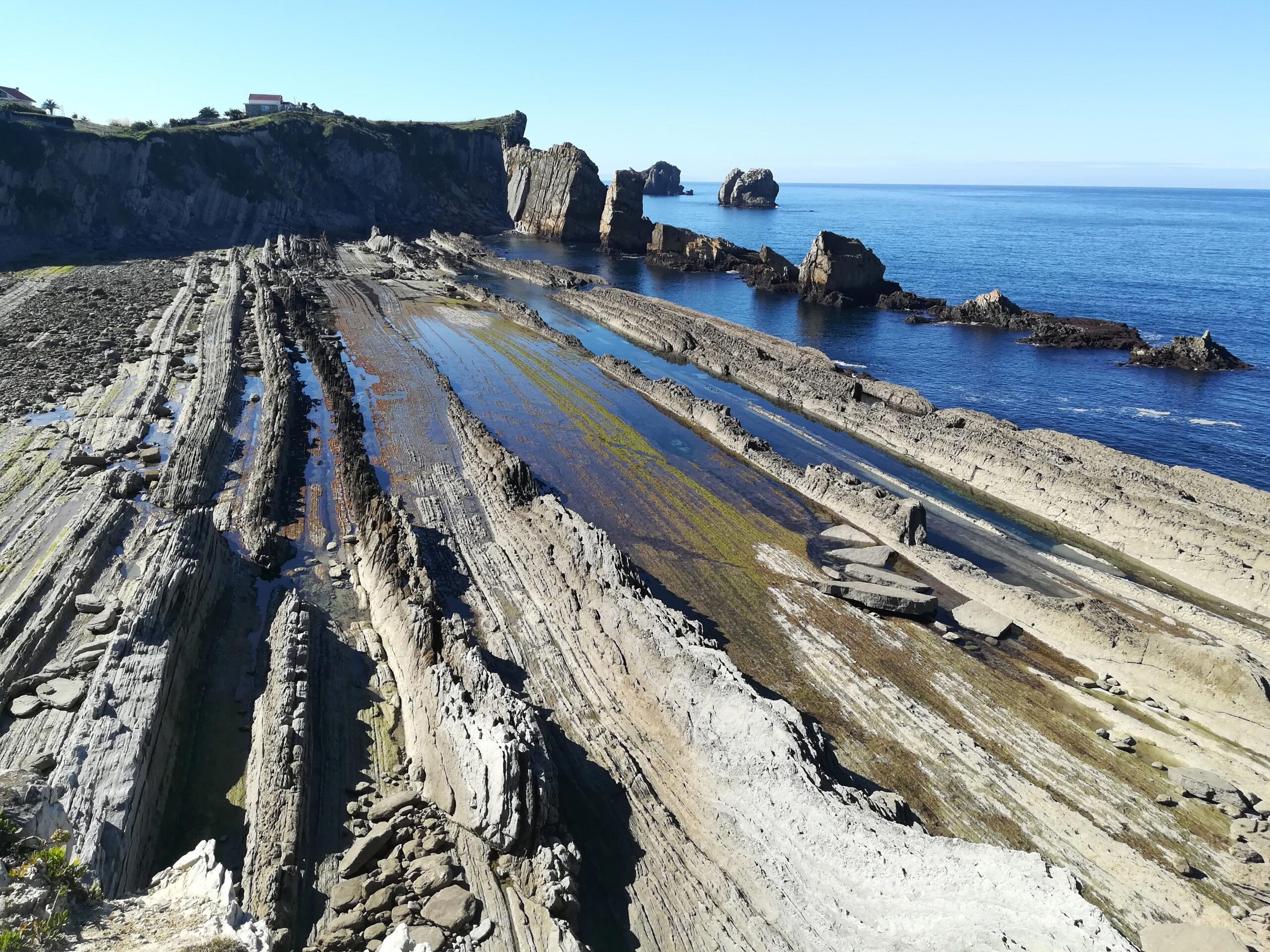
This natural area stretches from the western shore of the Mogro estuary to the Canal de Hoz, east of Liencres and north of Soto de la Marina, and part of the coastal stretch known as the Costa Quebrada, recently declared a UNESCO Global Geopark. It is one of the most representative coastal landscapes of the Cantabrian Sea, with a high concentration of marine erosion features such as cliffs, tombolos, urros (coastal islets), dunes, and abrasion platforms. The Costa Quebrada is, without a doubt, a magnificent example of the process of coastal retreat.

The Valdearenas beach dune system is one of the largest and most unique in the northern Iberian Peninsula. It is an active dune complex, with shifting dunes that stabilize inland thanks to the progressive development of natural herbaceous vegetation. This process was enhanced in the mid-20th century by planting a pine forest, which today acts as a buffer zone against the advance of the wind. It is also a prime spot for observing seabirds and migratory birds, especially at low tide.

Geological routes, interpreted walks, and panoramic views from La Picota, among other highlights, make this area an ideal destination for ecotourism, environmental education, and landscape photography year-round. Added to this is a valuable cultural heritage, with caves such as Altamira and El Pendo, which are part of the group of ten Cantabrian caves declared World Heritage Sites by UNESCO and revealing the deep connection between humans and this environment since prehistoric times.

Costa Quebrada Geopark

Information

El Costa Quebrada Geopark It is ideal to visit throughout the year thanks to the great diversity of experiences it offers in any season.

In spring, the surroundings are filled with color with the flowering of coastal species, and the mild temperatures invite you to explore its trails and cliffs, where the light enhances the green and turquoise of the seabed in the inlets.

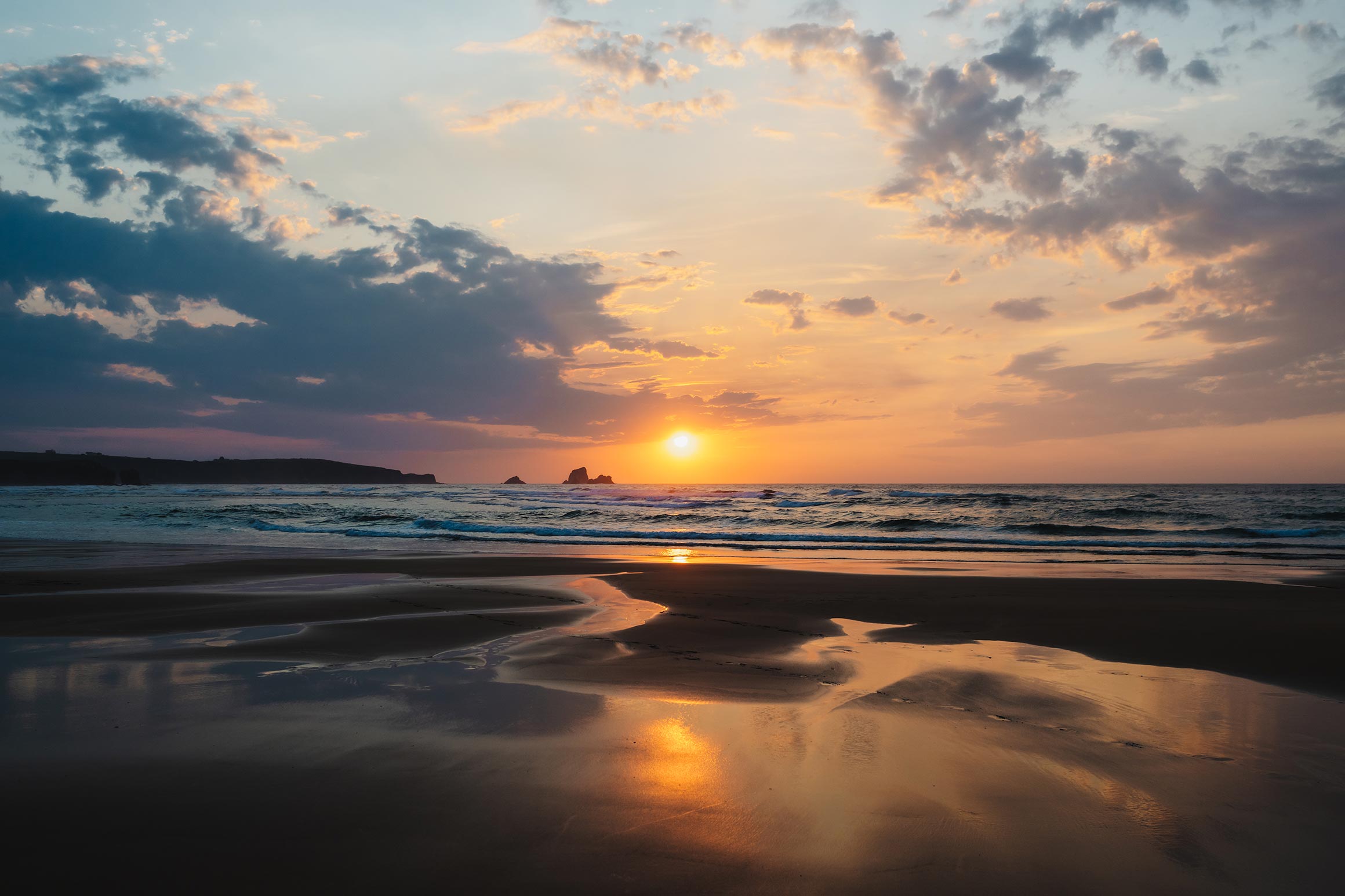
Summertime offers a chance to enjoy its beaches and coastal trails, as well as spectacular sunsets from the viewpoints. It's also a great place to swim in the beaches and coves that dot the entire coastline of this node.

Autumn brings a unique golden light for photography and is an excellent time for birdwatching.

In winter, the storms of the Cantabrian Sea transform the coastline into a visually striking backdrop, ideal for those seeking dramatic landscapes and nature photography. It's also a good time to observe seabirds such as the European shag and the yellow-legged gull, as well as the peregrine falcon, which nests readily on the park's cliffs, both on the mainland and in the Urros. Winter is also perfect for exploring caves such as Altamira and El Pendo.

The park's accessibility and proximity to urban centers make it especially attractive at any time of year.

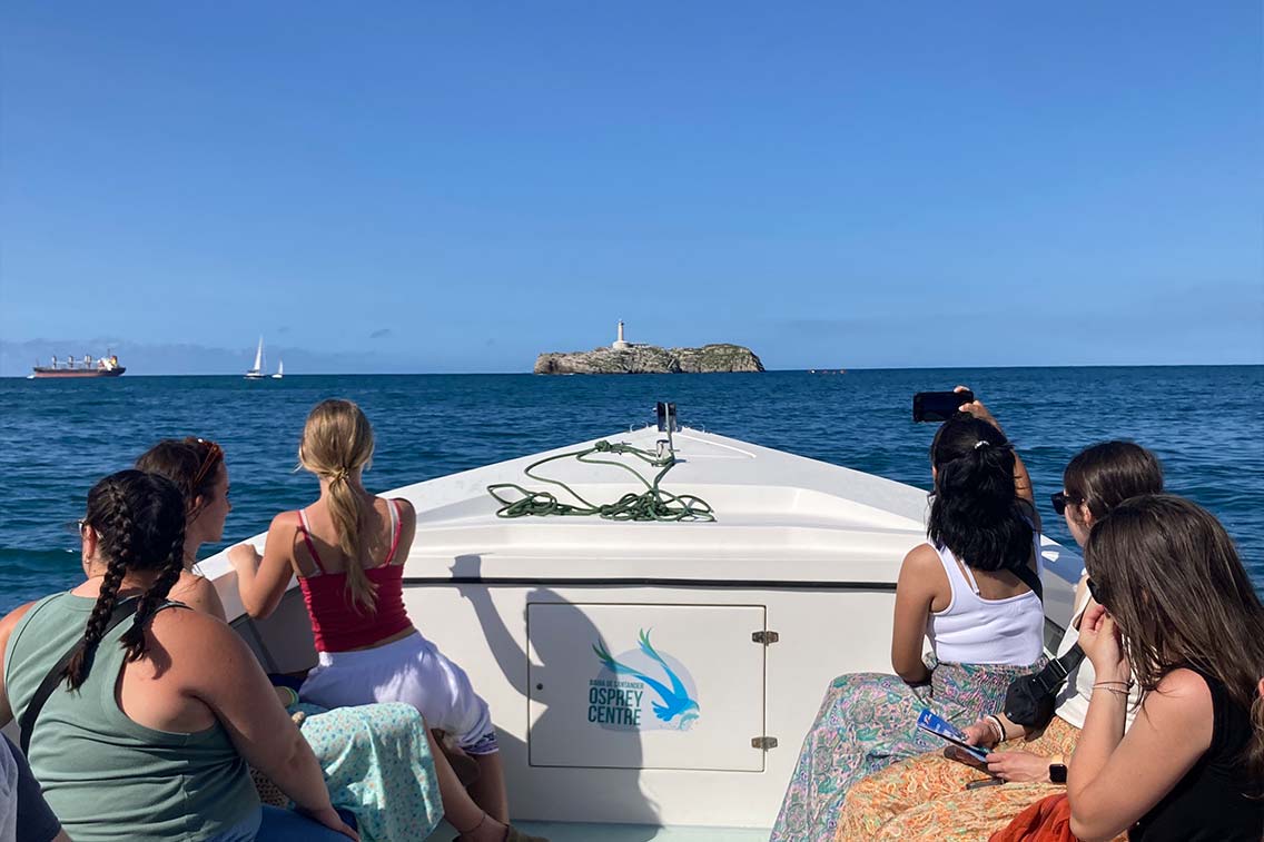
On Costa Quebrada Geopark A wide variety of activities are available, combining nature and landscape exploration. Geological trails provide a close-up look at the various processes that have shaped this unique coastline, allowing you to learn about the geological history and lithological diversity of the area, and how both have decisively influenced the erosional activity that has spectacularly shaped the landscape. Cliff routes, or nighttime visits to the intertidal zone on easily accessible rocky beaches—and, of course, with a guide—offer the opportunity to practice landscape photography. At night, visitors can also observe intertidal fauna and algae in abrasion pools. At low tide, the sandy beaches are prime birdwatching spots, especially during migratory migrations. The osprey is frequently present on Liencres beach. From the Mogro Estuary or from the top of La Picota, you can enjoy spectacular panoramic views of the Natural Park. Several local companies offer environmental interpretation activities, ecotourism, guided geological tours, boat trips, stargazing from the sea, scuba diving, and flora, fauna, and mushroom-watching experiences.

  • SAC Liencres Dunes and Pas Estuary
  • UNESCO Global Geopark Costa Quebrada

El Costa Quebrada Geopark It offers an extraordinary variety of coastal landscapes, accessible via different routes and viewpoints. The Liencres beach dune system, one of the largest in the Cantabrian Sea, is an emblematic place where shifting dunes, an extensive pine forest crisscrossed by pleasant walks, and sweeping views of the sea, especially attractive at sunset, combine. From this area, you can explore other areas of high geological and scenic value: Somocuevas beach, with open views to the east; Portío beach, which allows you to observe the strata in the cliffs; and the Urros, small islands visible from the top of the cliff. 

Further east, Arnía Beach stands out, a perfect example of a marine abrasion platform, and Covachos Beach, whose landscape is marked by the Castro tombolo, clearly visible from the path on the cliff. Completing the network of unique locations are Virgen del Mar Beach, and at the eastern end of the Park, in Santander, Mataleñas Beach, with spectacular views of Cabo Mayor and Cabo Menor, within the Costa Quebrada UNESCO Global Geopark. Furthermore, from the summit of La Picota, on the outskirts of Liencres and at an altitude of approximately 300 meters, there are exceptional panoramic views of the Park and the Cantabrian coastline.
THINGS TO DO

Surrounding Areas

These are the experiences that take place in the Costa Quebrada Geopark

accommodations

Where will you stay?

Lorem ipsum pain sit amet, consectetur adipiscing elit, sed do eiusmod tempor incididunt ut labore et dolore magna aliqua. Ut enim ad minim veniam.

Cruceiro House

Lorem ipsum dolor sit amet, consectetur adipiscing elit, eiusmod tempor.

ECOTOURIST RESERVE

Cartographic Viewer

Explore the 25 protected natural areas that make up the Green Spain Ecotourism Reserve on the map. Locate each node, learn about its surroundings, and plan your ecotourism route visually and intuitively.

LATEST NEWS

News