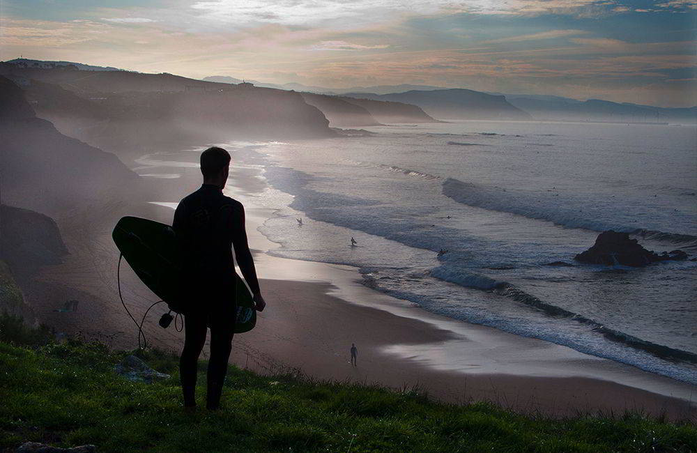
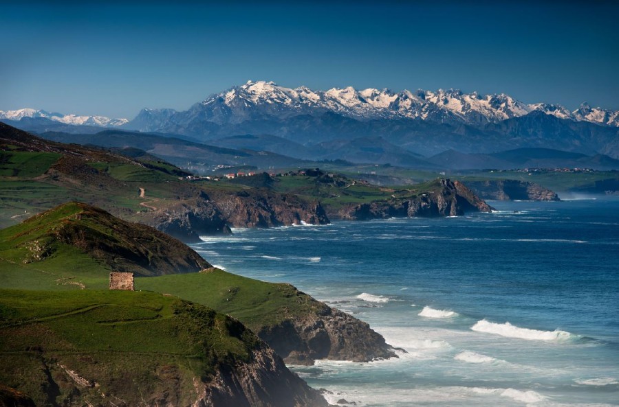
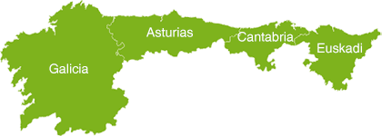
Wherever land and sea meet, very, very interesting things tend to happen. For example? Rocky ridges that could be the dorsal fin of a dragon, giant beaches, marshlands that change radically with the tides… We have selected four places in Green Spain with unique attractions and distinctive features: the variety is such that you’ll feel as though you’ve discovered an entire continent.
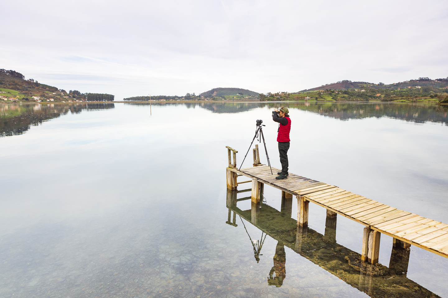
Partial Nature Reserve of the Villaviciosa Estuary. Asturias
Where is the Partial Nature Reserve of the Villaviciosa Estuary located?
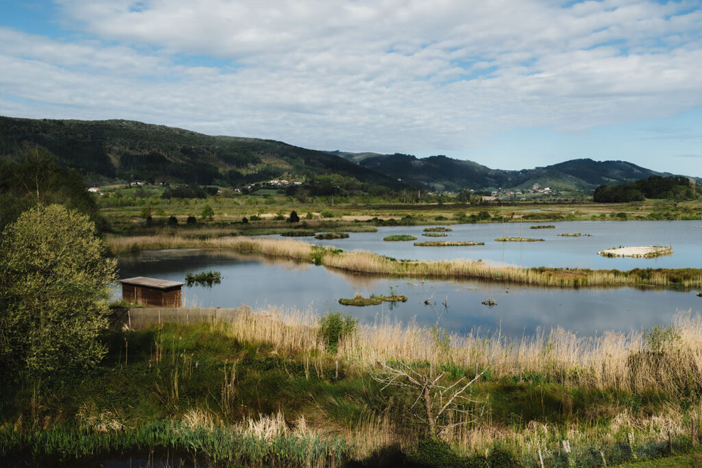
All you need to do is open Google Maps, search for the town of Villaviciosa in Asturias and discover the great scar of fresh and salt water that cuts in from the Cantabrian Sea right up to the very gates of the town. That is it—there you have it: the Villaviciosa Estuary Nature Reserve, nearly 8 linear kilometres of beaches, dunes, marshes, a small island, streams and rivulets protected since 1995. One thousand hectares (that is, a thousand football fields) of nature in one of the best-preserved estuaries on the Cantabrian coast.
What makes the Partial Nature Reserve of the Villaviciosa Estuary special?
The estuary is a true paradise for passionate nature lovers—but also for those who, even without knowing the scientific name of the Mediterranean Gull or the best month to watch the passage of the Bluethroat, still enjoy such a breathtaking natural setting. Its greatest value lies in the extraordinary biodiversity it shelters: more than 150 species of waterbirds (some of them quite uncommon) use this wetland as a wintering area or a migratory stopover. A pair of binoculars is enough to easily spot, especially during the colder months, grey herons, cormorants, curlews or mallards. The fact that the reserve is surrounded by other quintessential Asturian icons (green meadows and softly contoured mountains) or that it neighbours Villaviciosa, the capital of Asturian cider, are other strong points well worth bearing in mind.
What shouldn’t I miss in the Partial Nature Reserve of the Villaviciosa Estuary?
- The most popular route starts next to the Estuary Interpretation Centre, located at the port of El Puntal. From there, a signposted trail lets you walk along the estuary while watching birds from the viewpoints of El Cierrón and Misiego. Nor should we overlook the human constructions that, for centuries, have tried to harness the ‘energy’ of the estuary and the tides, such as the mills or the traditional jetties.
- Another essential stop is Rodiles Beach, one of the most beautiful in Asturias and backed by a eucalyptus forest with an almost perfect geometry. Its protected dunes form a singular ecosystem where native plants and wading birds coexist. For those seeking calm and observation, low tide is the best time: when the water retreats, the estuary becomes a damp desert where life emerges.
What secret place can I discover near the Partial Nature Reserve of the Villaviciosa Estuary?
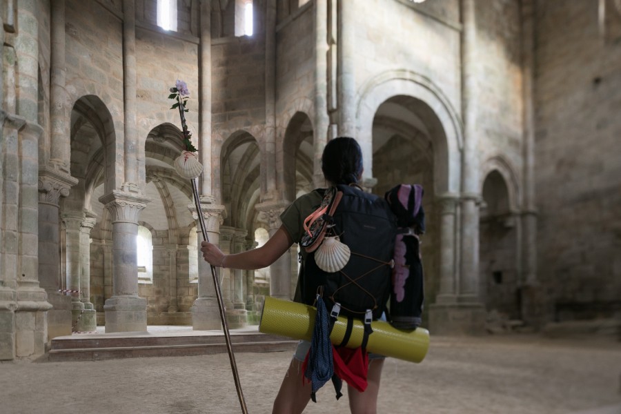
One where contrast is guaranteed. Just a few kilometres inland stands the church of San Salvador de Valdediós, nicknamed the “conventín” because of its small size. It is well worth visiting this Romanesque jewel (and its sister monastery), surrounded by meadows and forests, a must-stop on the Northern Routes of the Camino de Santiago.
Costa Quebrada Geopark. Cantabria
Where is the Costa Quebrada Geopark located?
It couldn’t be simpler: the geopark begins right at the gates of Santander, on the western coast of the capital, and runs for twenty kilometres of shoreline to the Cuchía Beach in Miengo, near the mouth of the Saja River. It encompasses around twenty kilometres of extraordinary geological richness that can be appreciated (and enjoyed) from land or from the sea. The great treasure of the Geopark lies in its many forms of marine erosion—cliffs, tombolos, urros (small coastal islets), dunes or wave-cut platforms—alongside the natural attractions of a coast as fortunate as Cantabria’s: immense surf beaches, sheltered coves, pinewoods by the sea or extensive wetlands.
What makes the Costa Quebrada Geopark special?
One fact is enough to show just how special this stretch of coast is: elsewhere, you would need more than 100 kilometres to find the same geological variety that is concentrated here in barely 20. Some have described it as an open-air natural laboratory in which to appreciate the experiments Nature has carried out over the last 120 million years. They’re not wrong—but that equation is missing a few ingredients: charming villages, green meadows that die into the sea, sunsets to be enjoyed from countless viewpoints (the Costa Quebrada is a premium destination for photography lovers) and, of course, Cantabrian gastronomy. All of this was very much taken into account by UNESCO, which added Costa Quebrada to its network of Global Geoparks in 2025.
What shouldn’t I miss in the Costa Quebrada Geopark?
- Valdearenas Beach. A vast sandy beach watched over by mobile dunes and ideal waves for surfers. It forms part of the Natural Park of the Liencres Dunes—or, in other words, a good handful of trails to forget the everyday noise.
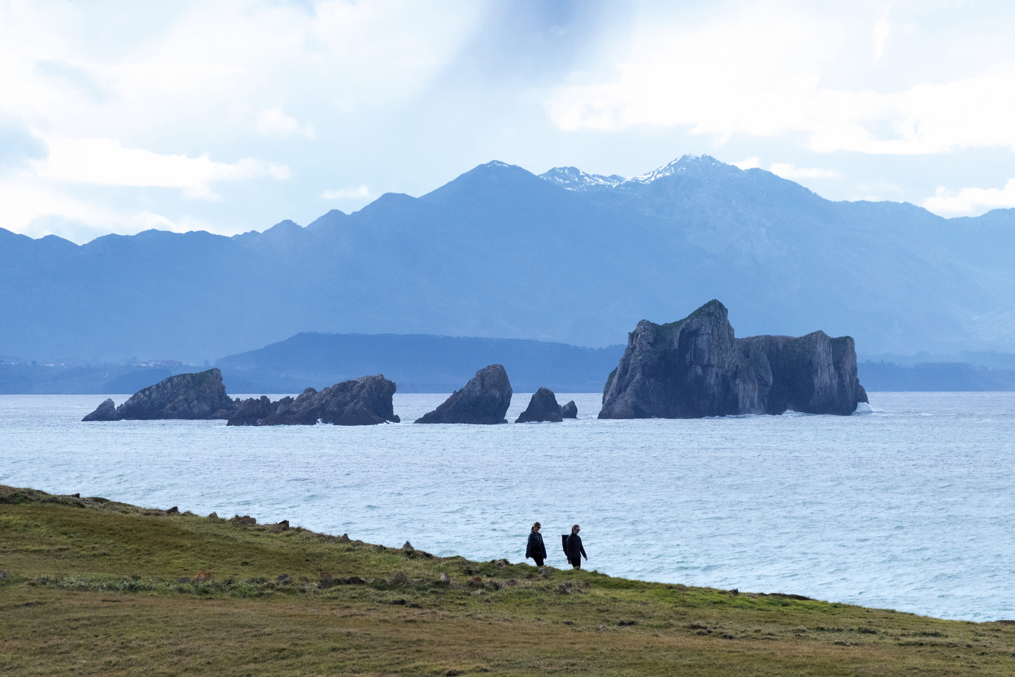
- La Arnía Beach. It might look like the set of a sword-and-sorcery film, but no: it’s real. A beach protected by rocky walls that rise from the sea like the fins of a school of sharks.
- La Picota viewpoint, next to the Mogro estuary. A privileged spot to watch the sunset and take in the last meanders of the estuary, the western coast, Valdearenas Beach or the meadows that carpet Cantabria.
What secret place can I discover near the Costa Quebrada Geopark?
A few kilometres inland, hidden among hills and green meadows, lies the Pozo Tremeo, a curious circular lake in Polanco. This enclave, surrounded by oaks and legends, is a doline—a cavity of karst origin—that changes level with rainfall and underground tides. Popular belief says it is an “eye of the sea,” a window that connects to the very entrails of the Cantabrian, and that it lies within the Costa Quebrada park itself.
Basque Coast Geopark. Euskadi
Where is the Basque Coast Geopark located?
In one of the most fortunate and least-known stretches of the Gipuzkoan coast, just about thirty minutes from Donostia/San Sebastián and separated by a small coastal range from the touristy Zarautz. The Basque Coast Geopark extends across the municipalities of Mutriku, Deba and Zumaia, along a coastal strip of almost twenty kilometres, and hides a geological treasure unique in the world: an open book, written over millions of years, in which you can read, among many other stories, the moment when a great meteorite struck the Earth. Anything else you should know? Yes: in 2015 it was declared a UNESCO Global Geopark.
What makes the Basque Coast Geopark special?
Beyond the natural beauty of these places and the charm of the towns that structure the geopark, there is one word worth memorising: “flysch.” It is a German term meaning “to flow,” “to slide,” or “slippery ground,” and it refers to the layered rock formations that can be seen along almost the entire Basque coast here: on the cliff faces, on the coastal bed, or even pushing into the beach sand.
Nowhere else in Europe can you observe with such clarity the continuous sequence of geological strata that narrate the great episodes of the Earth as if it were a natural archive of time.
What shouldn’t I miss in the Basque Coast Geopark?
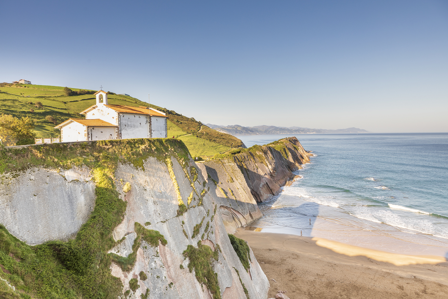
- The Itzurun Beach in Zumaia, perhaps the most urban (and most shaped by human hands) stretch of flysch, but with a very special attraction: the hermitage of San Telmo was a filming location for the movie ‘Ocho Apellidos Vascos’, and the beach can be seen in the series ‘Game of Thrones’.
- The Baratzazarrak viewpoint, which offers a gigantic panorama of the coast and reveals how the mountains have been sliced away where they meet the sea.
- The Sakoneta Beach, where the flysch is displayed in all its splendour and yields photographs that could have been taken on another planet in the Solar System.
What secret place can I discover near the Basque Coast Geopark?
It is worth driving up the road that heads south towards Lastur, a small green valley inhabited by just a few farmhouses, a traditional mill and a frontón that surprises with its large size. A curiosity: the Lastur valley has its own breed of cattle, one of the oldest in Europe—the betizu or larrabehiak.
Maritime-Terrestrial National Park of the Atlantic Islands of Galicia. Galicia
Where is the Maritime-Terrestrial National Park of the Atlantic Islands of Galicia located?
It isn’t easy to explain, because this park is spread across four different spaces—four privileged archipelagos along the Galician Atlantic coast—distributed across the southern half of the Rías Baixas. In other words, it’s not a park to be explored from behind a steering wheel, but from a boat. Better to forget about wheels and get used to rudders. Starting in the north and very close to the mainland we find Cortegada Island, in the Arousa estuary; farther offshore, but also in Arousa, Sálvora Island; travelling south we come to the Ons archipelago, which shields the estuaries of Pontevedra and Aldán and, finally, closing off the Vigo estuary, the Cíes archipelago.
What makes the Maritime-Terrestrial National Park of the Atlantic Islands of Galicia special?
It isn’t easy to condense all this into a single answer. If an island is often a continent in miniature, imagine what these archipelagos can offer. We are looking at a unique collage that includes nearly every possible marine landscape (both above and below the surface): a collage that combines white-sand beaches and dunes contrasting with rugged cliffs, pinewoods and seagrass meadows; untamed forests after decades of almost wild vegetal growth (as on the very special island of Cortegada), bird colonies of global importance and, no less important, highly valuable seabeds under extraordinary protection. One fact makes it clear: of the 8,480 hectares that make up the National Park, only 1,194 belong to the land surface of islands and islets. The rest—7,285 hectares—are protected marine area. In other words: what you can’t see is just as important as what you can.
What shouldn’t I miss in the Maritime-Terrestrial National Park of the Atlantic Islands of Galicia?
- Cortegada Island. A true rarity on the northern coastline. An island that was gifted and forgotten for decades, becoming what it is today: a truly singular forest, scarcely inhabited except for a few ruins, and a wonderful place to wander.
- The lighthouse and cliffs of Ons: one of the classic excursions from beautiful Sanxenxo—an island with quiet beaches, walking trails and a romantic lighthouse.
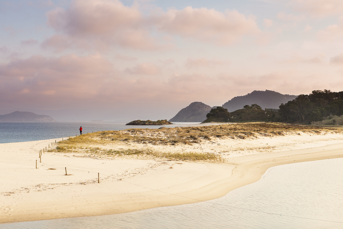
- Rodas Beach in the Cíes Islands: perhaps the park’s most famous postcard—a dreamlike beach with a distinctly Caribbean look—highlighted by the New York Times as one of the most spectacular in Europe.
What secret place can I discover near the Maritime-Terrestrial National Park of the Atlantic Islands of Galicia?
Speaking of islands… let’s continue with another one. A very special island that shares some of the wild appeal of the archipelagos mentioned above but with a more human touch: Arousa Island. Connected to the mainland by road, Arousa is an inhabited island with cultural resources such as the old Goday canning facilities and idyllic beaches like Area da Secada.
Connected to the mainland by road, Arousa is an inhabited island with cultural resources such as the old Goday canning facilities and idyllic beaches like Area da Secada.